Executive dashboard
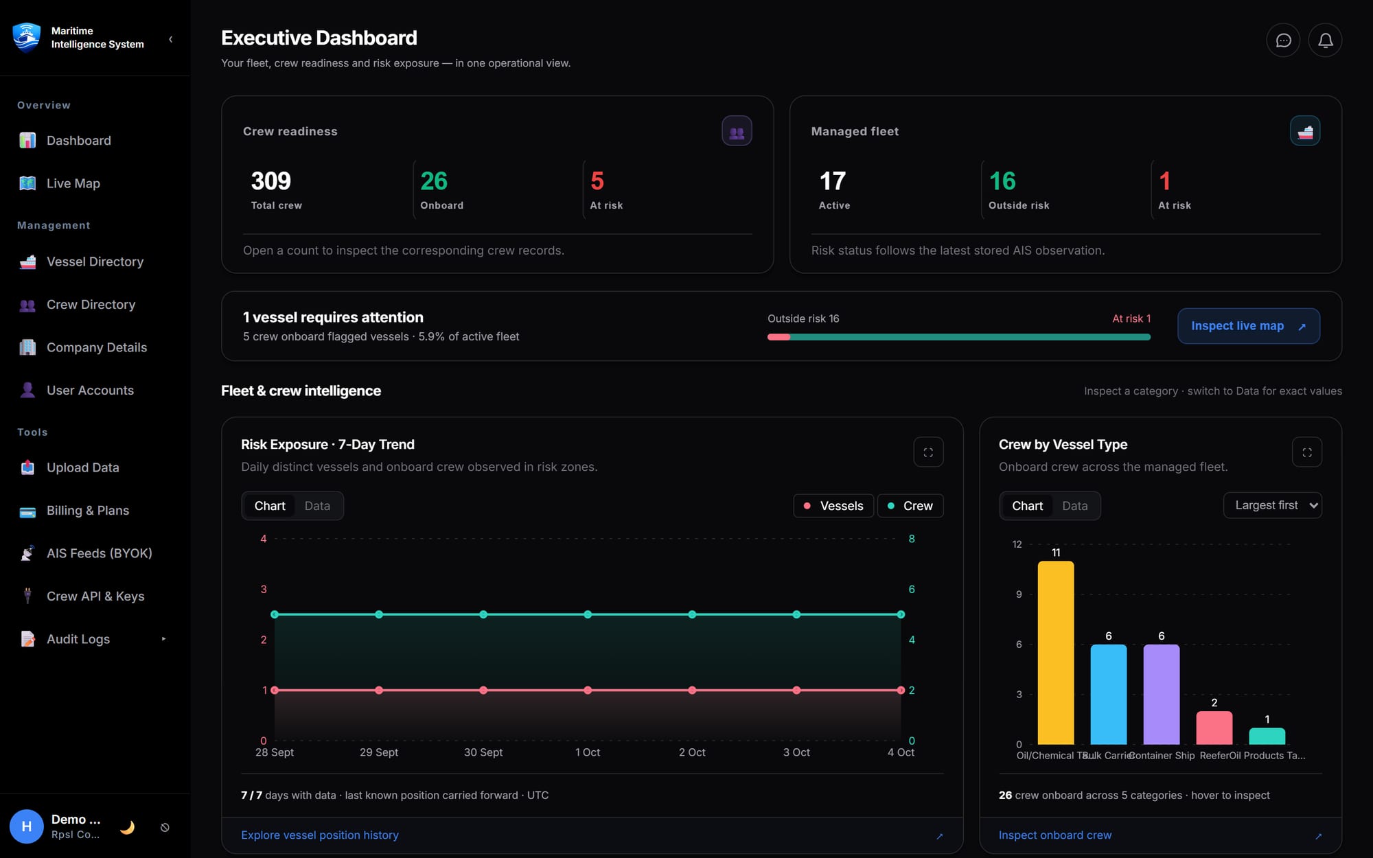
Fleet size, crew readiness and risk exposure in one operational view, with drill-downs into every number.
 MaritimeIntelligence System
MIS Ocean, the Maritime Intelligence System, brings real-time AIS, voyage playback, crew engagement and weather risk into a single workspace built for commercial fleets.
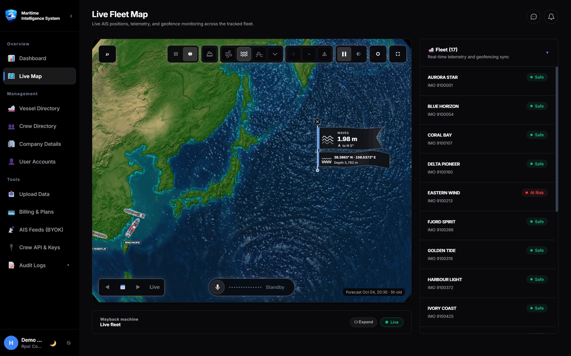
Real-time AIS tracking and vessel visibility across the globe, on a 2D chart or an interactive 3D globe.
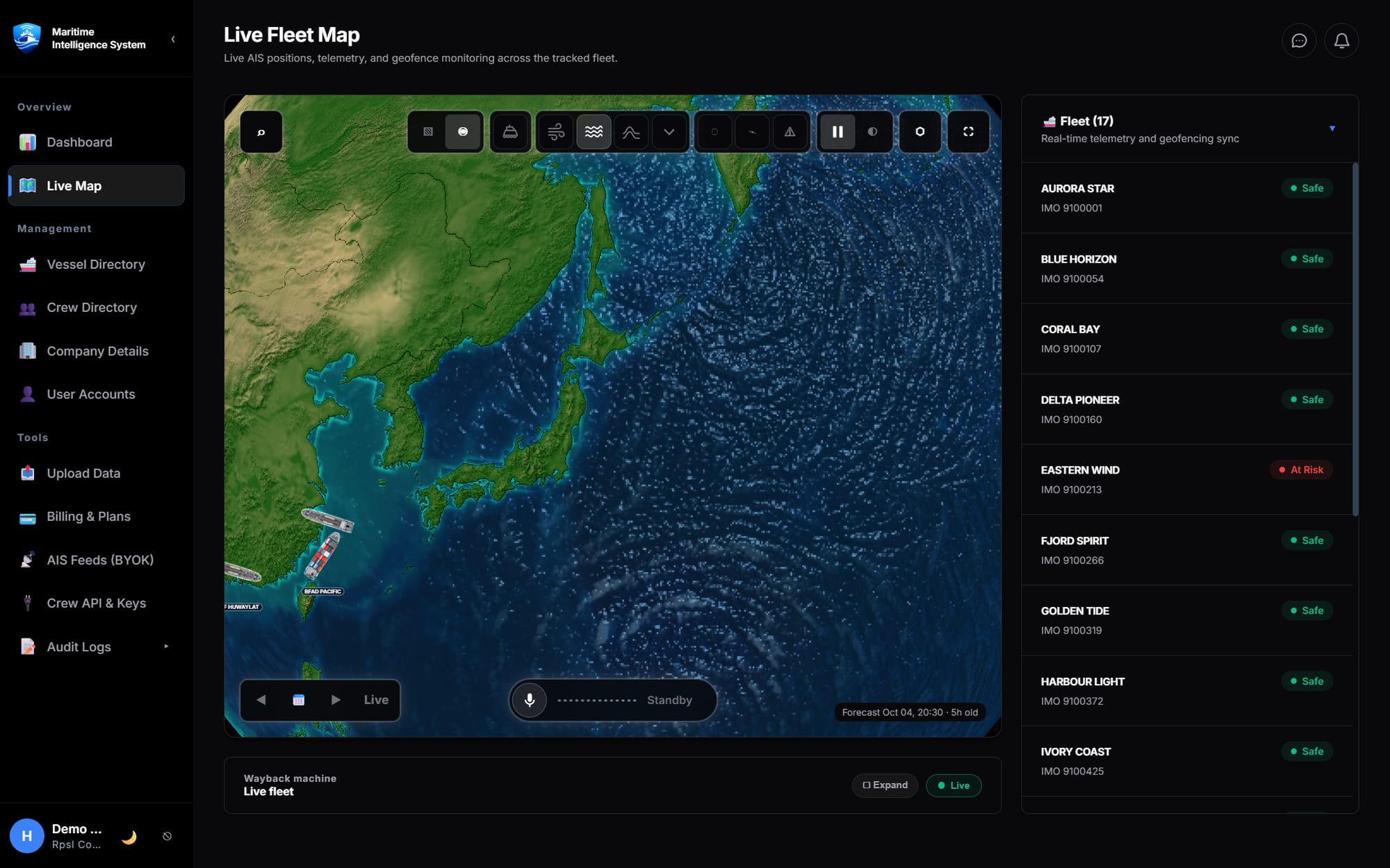
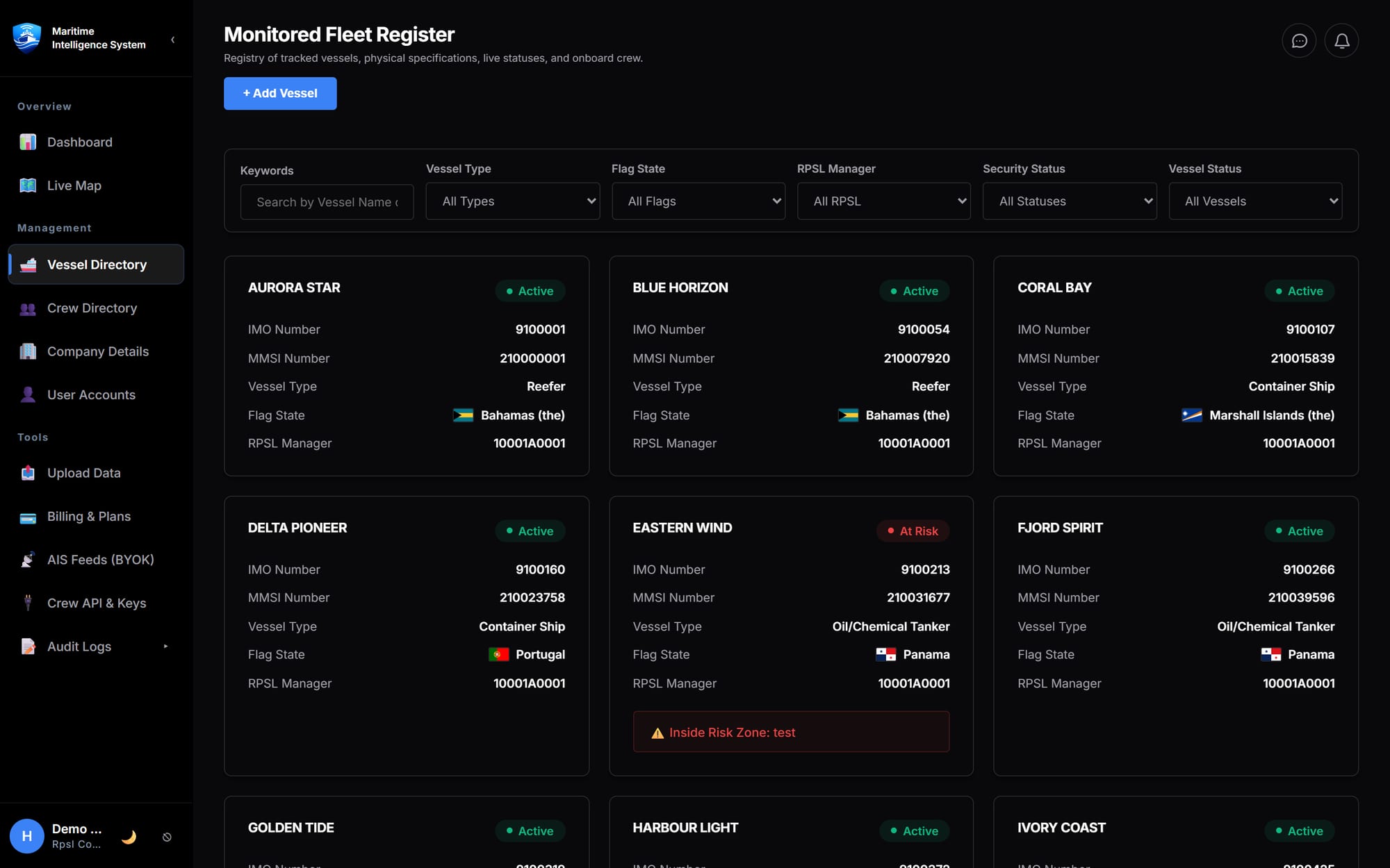
Land-based AIS traffic sits alongside your managed vessels, so congestion, neighbours and routes are clear at a glance.
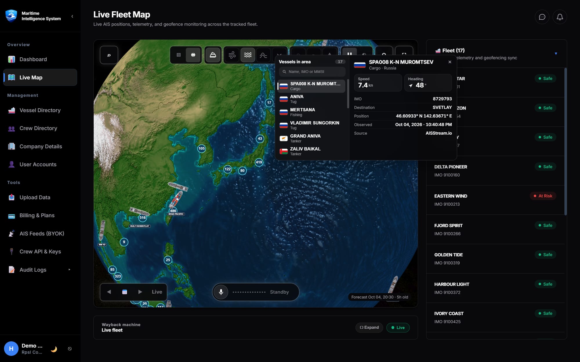
Replay your fleet's voyages, crew movements and weather history on one interactive timeline.
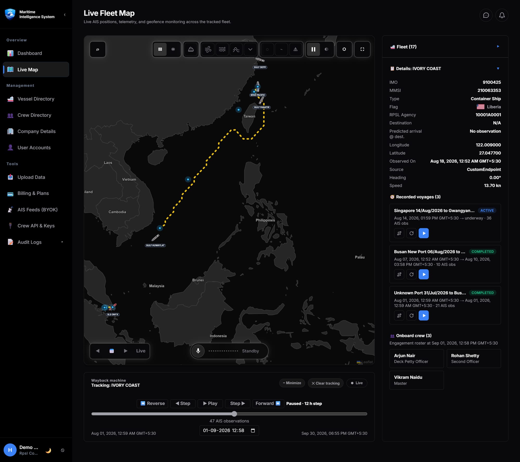
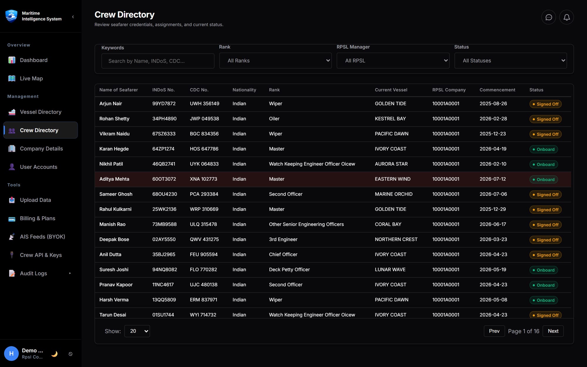
Track crew sign-on and sign-off, with every crew history synchronised to voyage playback.
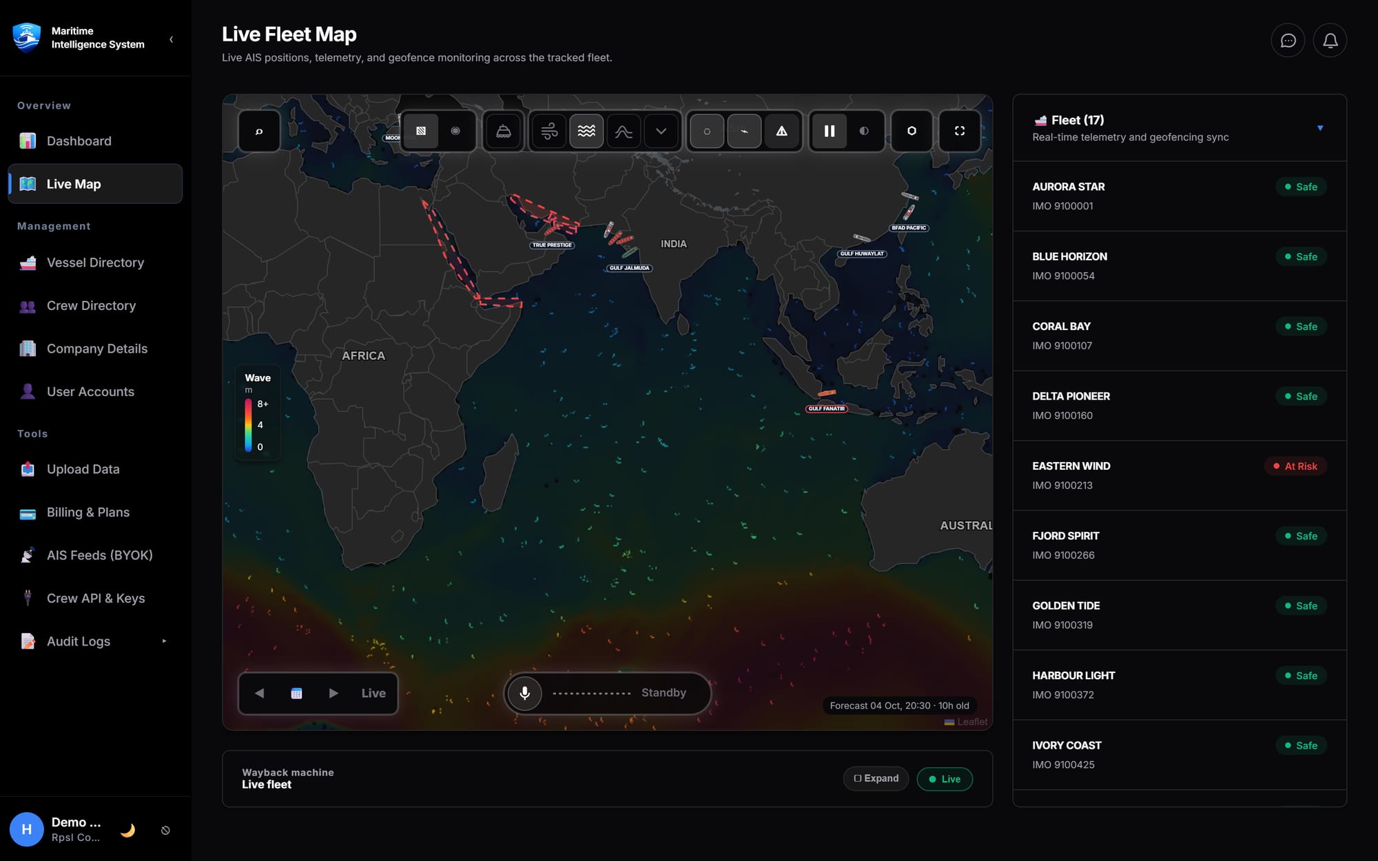
Live forecasts, risk alerts and visualisation, with weather history built into voyage playback.
From the first position report to the audit trail, MIS keeps operations, crewing and compliance on the same page.
Fleet size, crew readiness and risk exposure in one operational view, with drill-downs into every number.
Machine learning on AIS history estimates routes and arrival times so planners see delays earlier.
Connect MyShipTracking, MarineTraffic or a custom endpoint with your own keys and watch usage and cost.
Push crew engagement from your crewing system with a commercial API, or import in bulk from Excel.
Ask Gemini about vessels, positions, traffic and weather hands-free while you work on the map. Included in the Pro and Max plans.
Authenticator-app or email MFA, recovery codes, role-based access and a complete audit log.
Manage your company profile, users and roles, and upload fleet and crew data from one place.
Run on the managed service, or choose an on-premises deployment on the Enterprise plan.
Sign in with Google for free live-map access, or register a commercial account for your company.
Add vessels, bring your own AIS key and import crew engagement from Excel or the REST API.
Watch the fleet live, rewind any voyage and act on weather and risk before it matters.
What MIS Ocean does, who it is for and what it costs.
MIS Ocean, the Maritime Intelligence System, is a web platform for commercial shipping fleets, ship managers and crewing agencies. It combines live AIS vessel tracking on a 2D chart or an interactive 3D globe, voyage playback, crew engagement records and weather and cyclone risk in one workspace.
Commercial shipping fleets, ship managers, global crewing agencies and large ship management corporations. Plus suits emerging operators and regional crewing managers, Pro suits commercial fleets and global crewing agencies, Max suits large shipping lines and ship management corporations, and Enterprise covers fleets of 200 or more vessels.
Yes. Sign in with Google for free access to the live map, with no card required. The free live map shows the shared layers: land-based AIS vessel traffic from around the world, weather, cyclone tracking and risk zones. Your own fleet, crew, voyage playback and the voice assistant need a paid plan.
Plus is USD 99 per month for up to 5 vessels with 3 months of history. Pro is USD 199 per month for up to 20 vessels with 1 year of history. Max is USD 299 per month for up to 100 vessels with 3 years of history. Enterprise pricing is custom.
MIS Ocean shows land-based AIS traffic for 35,000+ vessels worldwide, on the free live map and alongside your managed fleet on the paid plans. You can also bring your own AIS provider by connecting MyShipTracking, MarineTraffic or a custom endpoint with your own keys.
Yes, on the Pro and Max plans. Gemini voice navigation on the live map lets you ask about vessels, positions, traffic and weather hands-free.
Yes. Voyage playback replays AIS tracks, weather and crew sign-on and sign-off together on one timeline. How far back you can go depends on the plan: 3 months on Plus, 1 year on Pro and 3 years on Max.
Your company's crewing system sends crew engagement to MIS Ocean through the Crew Engagement REST API (Pro and Max plans): each sign-on and sign-off for a crew member on a vessel. MIS Ocean then shows who was on board each vessel on any date, in the crew directory, the vessel panels and voyage playback. You can also import in bulk from Excel on every paid plan.
Yes. It shows wind, wave and cyclone layers, tropical cyclone tracking with early-warning alerts for vessels in the path, and a 7-day forecast from NOAA model runs. You can click anywhere on the sea for wave height, direction and depth, and replay the weather a vessel actually sailed through.
Accounts use authenticator-app or email multi-factor sign-in, recovery codes, role-based access and a complete audit log.
Yes, on the Enterprise plan: an on-premises deployment in your own infrastructure under your own security policies. Otherwise MIS Ocean runs as a managed cloud service.
Sign in with Google for free access to the live map, no card required, then upgrade when your fleet is ready.